MyView
- Provider integrations behind one search
- 17
- Sensor families: optical, SAR, hyperspectral, thermal
- 4
- Days of passes ahead, from public orbital elements
- 14
- Steps from area to tasking request
- 5
Area
Box, polygon, place search or boundary file. Its size reads as you draw, and every module works from the active area.
- Box
- Polygon
- Measure
- Place search
- Boundary file
- Area 2
- 26.89 km²
- Stored as EPSG:4326
- WGS 84
Archive
One search across every provider and every sensor family. Each card states time, sensor, pixel size, bands, angle, cloud, and how much of your area it covers.
- Sep 25, 202609:28 UTC · Vantor WorldView-2
- Pixel size
- 56.6 cm
- Bands
- 9
- Off-nadir
- 26.10°
- Cloud
- 5.8%
OPT3.03 km²60.5% of 5.00 km² - Sep 25, 202609:27 UTC · Vantor WorldView-2
- Pixel size
- 53.9 cm
- Bands
- 9
- Off-nadir
- 22.90°
- Cloud
- 4.2%
OPT3.25 km²65% of 5.00 km² - Sep 17, 202609:25 UTC · Vantor WorldView-2
- Pixel size
- 58.1 cm
- Bands
- 9
- Off-nadir
- 27.53°
- Cloud
- 18.5%
OPT5.00 km²100% of 5.00 km² - Sep 16, 202607:02 UTC · Vantor WorldView Legion
- Pixel size
- 35.3 cm
- Bands
- 9
- Off-nadir
- 13.84°
- Cloud
- 15.9%
OPT5.00 km²100% of 5.00 km²
- Aug 14, 202616:19 UTC · MDA RADARSAT-2
- Pixel size
- 5.00 m
- Bands
- 1
- Off-nadir
- —
- Cloud
- n/a
SAR5.00 km²100% of 5.00 km² - Jul 4, 202616:15 UTC · MDA RADARSAT-2
- Pixel size
- 30.00 m
- Bands
- 1
- Off-nadir
- —
- Cloud
- n/a
SAR5.00 km²100% of 5.00 km² - Jun 27, 202616:19 UTC · MDA RADARSAT-2
- Pixel size
- 5.00 m
- Bands
- 1
- Off-nadir
- —
- Cloud
- n/a
SAR5.00 km²100% of 5.00 km² - May 10, 202616:19 UTC · MDA RADARSAT-2
- Pixel size
- 5.00 m
- Bands
- 1
- Off-nadir
- —
- Cloud
- n/a
SAR5.00 km²100% of 5.00 km²
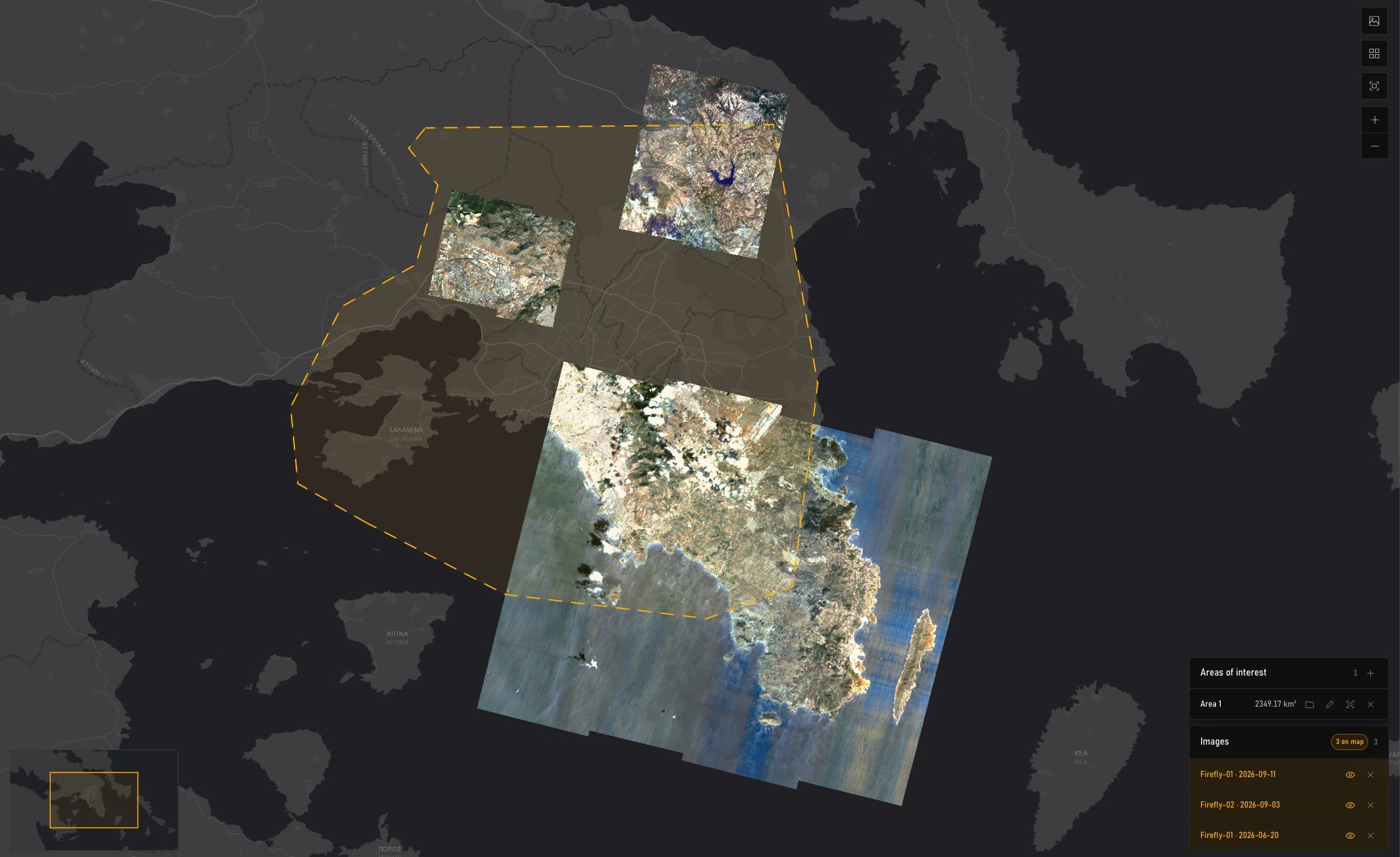
- Jun 20, 202609:41 UTC · Pixxel Firefly L2A
- Pixel size
- 5.00 m
- Bands
- —
- Off-nadir
- 22.25°
- Cloud
- 12.4%
HSI683.61 km²29.1% of 2,349 km² - Jun 11, 202609:35 UTC · Pixxel Firefly L2A
- Pixel size
- 5.00 m
- Bands
- —
- Off-nadir
- 9.90°
- Cloud
- 7.0%
HSI166.79 km²7.1% of 2,349 km² - Jul 14, 202609:38 UTC · Pixxel Firefly L2A
- Pixel size
- 5.00 m
- Bands
- —
- Off-nadir
- 14.74°
- Cloud
- 23.9%
HSI101.01 km²4.3% of 2,349 km²
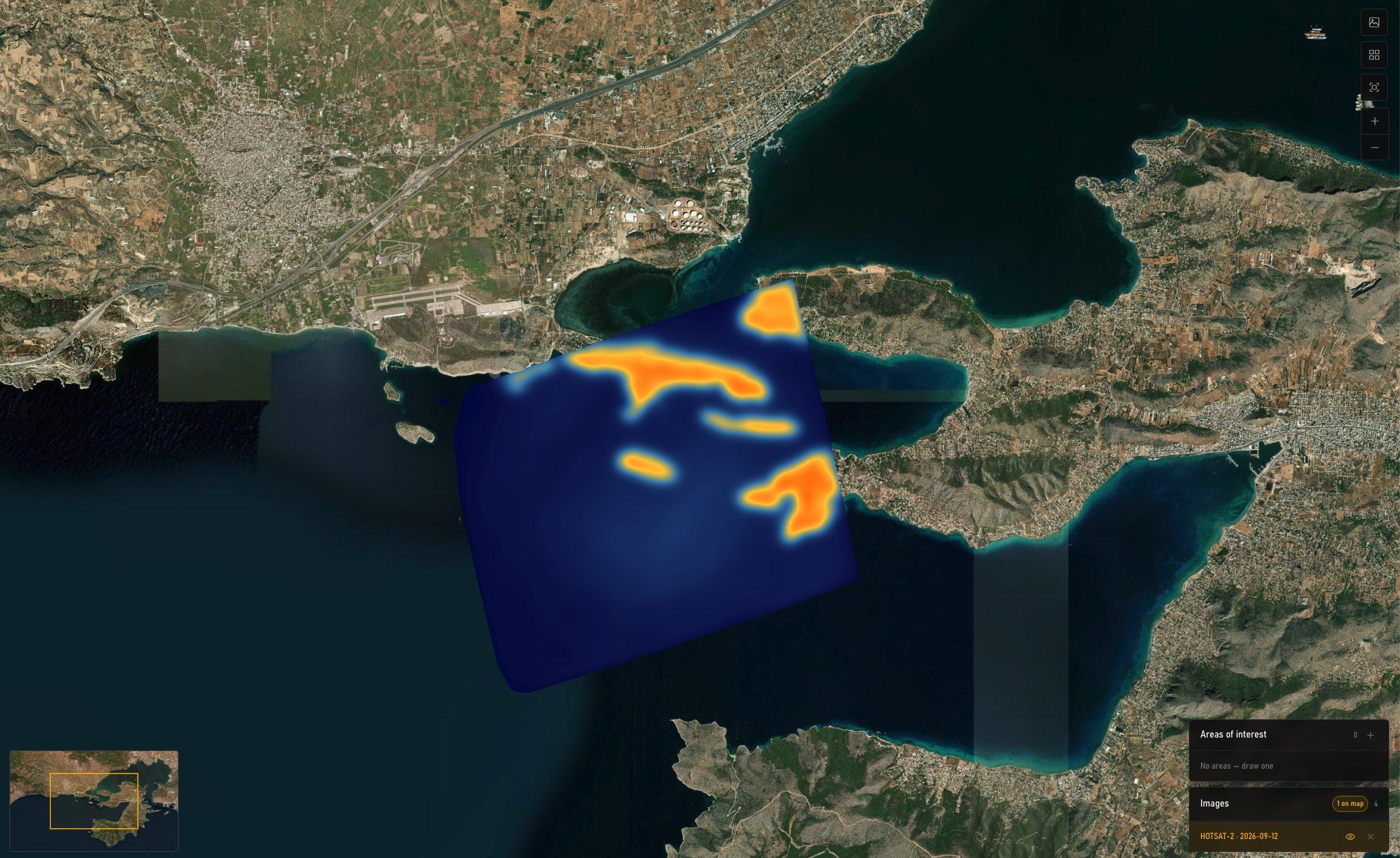
- Sep 12, 202612:52 UTC · SatVu HotSat
- Pixel size
- 4.18 m
- Bands
- 1
- Off-nadir
- 24.26°
- Cloud
- 0%
TIR23.49 km²1% of 2,349 km² - Jul 5, 202601:40 UTC · SatVu HotSat
- Pixel size
- 3.79 m
- Bands
- 1
- Off-nadir
- 14.84°
- Cloud
- 12%
TIR18.79 km²0.8% of 2,349 km² - Sep 3, 202601:31 UTC · SatVu HotSat
- Pixel size
- 3.57 m
- Bands
- 1
- Off-nadir
- 5.22°
- Cloud
- 25%
TIR16.44 km²0.7% of 2,349 km²
Passes
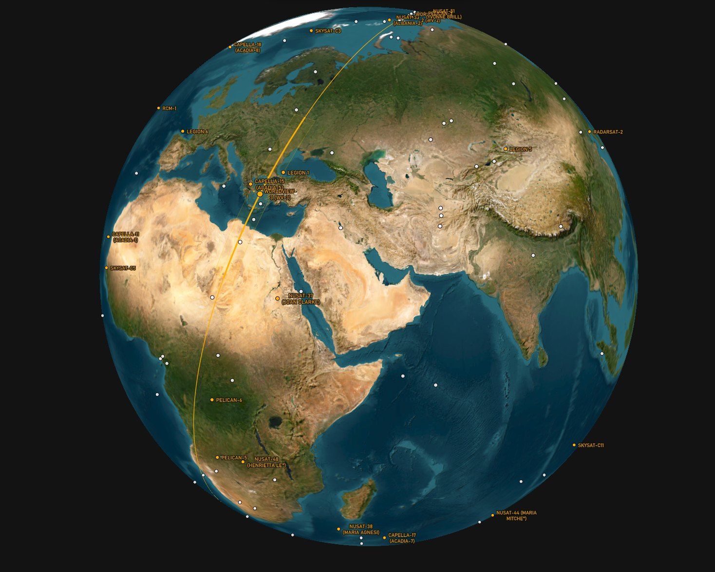
Every satellite over the area for the next 1 to 14 days, with its swath drawn on the globe at the moment of the pass. Task straight from the row.
- 12:25NuSat-54Satellogic · 0.7 m · 5 km swath · off-nadir 40° · ascending · ETask
- 12:56Legion 5Vantor · 0.31 m · 9 km swath · off-nadir 19° · descending · NETask
- 13:14NuSat-53Satellogic · 0.7 m · 5 km swath · off-nadir 48° · ascending · WTask
- 13:31SkySat-C9Planet Labs · 0.5 m · 5.9 km swath · off-nadir 34° · descending · ETask
- 14:04SkySat-C7Planet Labs · 0.5 m · 5.9 km swath · off-nadir 46° · descending · WTask
- 14:17Legion 3Vantor · 0.31 m · 9 km swath · off-nadir 21° · ascending · NWTask
- 14:20SkySat-C11Planet Labs · 0.5 m · 5.9 km swath · off-nadir 47° · descending · ETask
Optical · daylight only · off-nadir up to 50° · next 14 days
Next 3 days
- Optical107
- SAR93
- Other3
Tasking
Five steps to a provider-ready request: what, when and within which bounds, how it is produced and delivered, and a summary before anything is committed.
- Type
- Optical
- Provider
- Vantor
- Area of interest
- Area 2 · 26.89 km²
- Priority
- Urgent: first opportunity, premium tier
- Window
- 2026-09-29 → 2026-10-13
- Resolution
- 15 cm
- Maximum cloud
- 20%
- Maximum off-nadir
- 10°
Projected passes
Pass (UTC) Satellite Off-nadir 2026-09-30 07:40 Legion 5 NE 2.3° 2026-09-30 09:13 GeoEye-1 S 8.1° 2026-09-30 09:31 Legion 1 S 2.5° 2026-10-01 07:25 Legion 5 NE 7.5° The soonest passes within 10°, from public orbital elements. A projected pass says the satellite will be overhead; only the provider can say it will be pointed at you.
- Product
- WorldView Legion Tasking, 15 cm HD
- Collection
- Vantor WorldView Legion
- Processing level
- Orthorectified
- Resolution
- 15 cm
- Delivery
- Clipped to the area ordered
- Destination
- Download link, e-mailed
- File format
- GeoTIFF
- Extent
- Clipped to the area requested
- Provider
- Vantor
- Product
- WorldView Legion Tasking, 15 cm HD
- Priority
- Urgent
- Area
- Area 2 · 26.89 km²
- Window
- 2026-09-29 → 2026-10-13
- Bounds
- Cloud 20% · off-nadir 10°
- Delivery
- Download link · GeoTIFF
API
Everything MyView does is available to your own systems through the MyView API: search, passes, tasking and orders from inside your GIS, portal or processing chain.
- Same catalogueEvery provider integration the app uses, behind one interface.
- Your interfaceSearch, task and order without leaving the tools your team already uses.
- Your accountOrders, licences and deliveries recorded against your organisation, as in the app.